Travel Planner
“The Beauty of Fall in the U.P.”
Episode #2110 Travel Planner
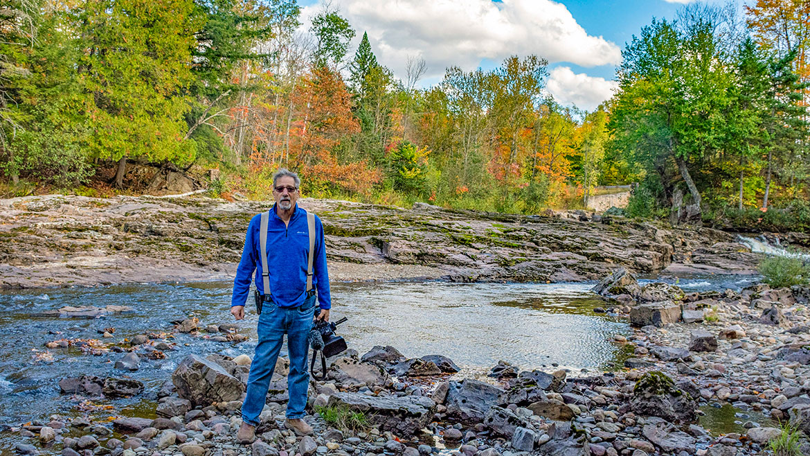
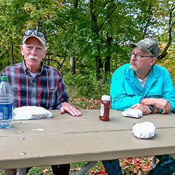
Our good friend and exciting adventurer Tod Poirier takes us on a color tour to remember. From the Dead River Basin to unbelievable overlooks, we see it all today.
Comment
share your thoughts on this episode and get information and guides to the areas featured by filling out our comment form
Comment Form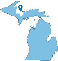
Marquette County, Michigan
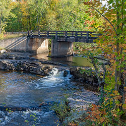
County Road 510 Bridge
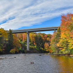
Location: where County Road 510 crosses the Dead River
near Negaunee, Michigan - Marquette County (46.558287332544545, -87.54610952917875)
The County Road 510 bridge over the Dead River in Marquette County, Michigan, is a popular destination for tourists and locals. In 2010 the new County Road 510 Bridge was completed upstream from the old bridge and the old bridge became a pedestrian bridge. The new bridge is 100 feet above the river and provides great views of the old bridge, the Dead River, and the surrounding forest. The views are especially spectacular in the Fall when the maple trees are changing colors. During the peak color season many visitors park right on the side of the road.
- CR 510 Bridge [Historical Marker Database]
- CR 510 Bridge View [Travel Marquette]
Old County Road 510 Bridge
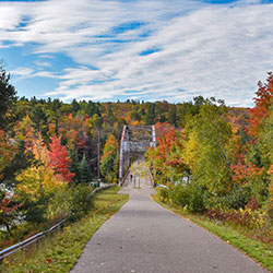
Location: connects Old County Road 510 & Bridgewood Lane over the Dead River
The original CR 510 Bridge is a rare Pennsylvania through truss highway bridge that was moved to its current location in 1921. A new bridge was built upstream in 2010. Visitors can fish, walk, or picnic at the bridge. Some say it's a popular place for bridge jumping, although this is not recommended. After many years of planning and design, plans were finalized for the new bridge 1,300 feet upstream from the steel bridge. The building of the new bridge came just in time as the weight limit on the steel bridge was lowered to 25 tons in May of 2009. This bridge weight limit shut off this route to almost all truckers in the area, including snowplows for the Marquette County Road Commission; the bridge itself had to be plowed with a pickup truck. The bridge is of historical significance as there is only one other similar structure in the state. For that reason, the steel bridge remains in its original location. The steel bridge can be viewed by looking to the east of the new crossing or by driving down to the end of the old County Road 510.
- Old CR 510 Bridge [Historical Marker Database]
- Old CR 510 Bridge [Historic Bridges]
Dead River Storage Basin
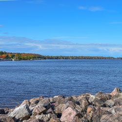
Location: spanning Negaunee, Ishpeming and Champion Townships - Marquette County, Michigan
DNR Boat Ramp
Location: 46.56481233837382, -87.56422221600914 (access from Hoist Dam Road)
Managed by Van Riper State Park, the Dead River Storage Basin is 10 miles northwest of Negaunee and spans 2,724 acres in size. This is a great spot for camping, boating, spending the day on the lake or fishing! Dead River Storage Basin has a large population of Sunfish, Northern Pike, Smallmouth Bass, Walleye and Yellow Perch. There is a hard-surfaced ramp available to provide easy water access that can accommodate all trailerable watercraft. The launch site also has plenty of parking, as well as restroom facilities available.
Big Pup Creek / Big Pup Falls
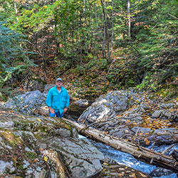
Location: Less than two miles south of County Road 510's bridge over the Yellow Dog River there is another, smaller bridge over Big Pup Creek. Park near the bridge and head directly down to the creek. Follow the water downstream for a few hundred yards to view all of the upper falls.
To visit the larger lower falls you can either continue downstream through the brush and swamp for another mile or so or cut forward on the two-tracks.
Running alongside County Road 510 for a short time, Big Pup Falls is a set of waterfalls in a classic Huron Mountain setting. Multiple small drops over dark volcanic rock, hemmed in by mossy banks and tall trees, the upper drops on the creek makes a perfect setting for easy visits. This waterfall is on private property, so please respect the land in any posted restrictions. After the little Big Pup Creek flows over the main falls and past County Road 510 and it's weeping wall, it meanders through a few swamps on a leisurely path to Yellow Dog River. Then, suddenly, it tumbles down a set of impressive drops that seem totally out of place from most of its run. It crashes down over boulders, is pushed around by cuts of works, and roars before calming back down and sliding into the larger river below.
- Big Pup Creek Falls [Travel Marquette]
Thomas Rock Scenic Overlook
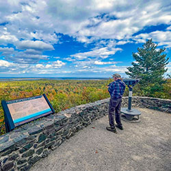
formerly known as GOBBLERS KNOB
Location: County Road 510 (1 Mile south of County Road 550) - Big Bay, Michigan
Thomas Rock in Big Bay is a great spot for a short hike boasting panoramic views of Lake Superior, lush forests, Big Bay, and on a clear day, the Keweenaw Peninsula. This overlook is accessible and easy to navigate, with railings, benches, and wide paths. The nature trail features interpretive signs identify a variety of wildflowers, trees, wildlife and plants along the trail. Spring has an explosion of wild flowers and Fall brings on the spectacular beauty of natures brilliant colors. Picnic tables and restrooms are extra amenities. Family-friendly. Dog-friendly.
- Thomas Rock [Travel Marquette]
Erick Road Creek
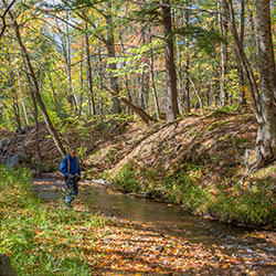
Location: Erick Road - Arvon Township, Michigan
We stopped at a small bridge crossing an unknown creek on Erick Road not far from Big Eric's Bridge. Nice spot for a wilderness creek hiking adventure.
Big Erick's Bridge / Falls / Campground
Location: Erick Road - Skanee, Michigan (46.86465098946906, -88.08247627175065)
Crossing Big Eric's Bridge on Erick Road over the Huron River is like crossing into another land. Paved road and signs are left behind, logging two-tracks and the wilderness take over. For the small size of Big Erick's Falls there is an awful lot to see here. Once the site of a bustling logging camp, this waterfall now has a state campsite, parking area, and one of the few bridges over the Huron River. The drops are small but uniquely structured, water pouring from one large pool to the next in short chutes over tough, layered rock. The name "Big Eric's Falls" carries a fascinating history, paying homage to a logger named Big Eric Erickson who worked in the area during the 1920s. His legacy lives on through this stunning waterfall, a constant reminder of the region's rich past and its connection to the logging industry. The secluded, rustic campground is on the pristine Huron River watershed and is very popular among fishermen for trout and steelhead runs. This great destination provides ease of access to a wilderness wonderland for hikers, hunters, ORV and outdoor enthusiasts.
- Big Eric's Bridge State Forest Campground [Michigan DNR]
- Big Erick's Falls [Baraga County]
Upper Peninsula Pasties
Location: Michigan's Upper Peninsula
Pasties were the original fast food of copper miners and lumberjacks. Brought here from the mining region of Cornwell, England, U.P. wives would fill the rolled-out dough with leftover beef, potato, onion and rutabaga, fold the pastry in half, seal the edges and bake. Legend says the miners would take these golden pastries into the mines and reheat them on a shovel over their lantern candles. They’re considered sacred among many life-long residents of the Upper Peninsula. Debates range far and wide on which pasty reigns supreme.
- Randall Bakery - Wakefield [Pure Michigan]
Huron River Mouth @ Lake Superior
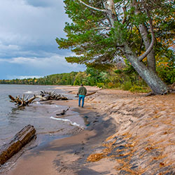
Location: NE Corner of Baraga County end of Huron Road (46.909823525195755, -88.0368360966496)
The Mouth of the Huron River, which flows into Lake Superior is just one of the many hidden spots that make the UP the wonderous place that it is. This windswept expanse of beach where the Huron River flows into Lake Superior is dotted with large pines and offers views of the Huron Islands. Not really “near” anything, the mouth of the Huron is remote, even by Upper Peninsula standards. Visitors to the Mouth of the Huron have described it as one of the best and most beautiful places to camp. If you’re looking for a primitive (no amenities) place to camp, it’s a great spot for that.
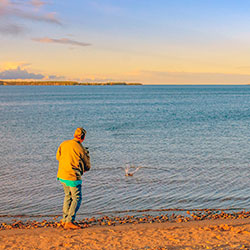
Keweenaw Bay - L'Anse
Location: L'Anse, Michigan
Keweenaw Bay is an arm of Lake Superior located adjacent to the Upper Peninsula, to the southeast of the Keweenaw Peninsula. Fishing, swimming, kayaking and boating are among the many activities you can do in the Keweenaw Bay at any of the beautiful beaches or many marinas around L'Anse. If you are a land person, enjoy ORV riding, bike riding, having a picnic, camping, hiking, snowmobiling, snowshoeing, looking at waterfalls, the Baraga Shrine, touching Mt. Arvon peak or just quiet solitude. We got you!!!
- L'Anse [Pure Michigan]
- Baraga County